Emergency Survival Gear – Any Mountain – What’s In The Bag
I’ve been lucky enough to do lots of climbing, hiking and camping over the last few years, both locally and slightly further afield. I’ve accumulated lots of gear over this time and also experience as in what to bring, and I’ve learned from some of the best in the business when it comes to mountaineering.
So even when I’m going off even for a short local hike, I’ll generally always have the bag with me for you just don’t know when things might not go according to plan, for myself or possibly I may encounter someone else caught up in some emergency of their own and I’d be able to assist them possibly.
So we needn’t overthink this. If you’re out in nature with a plan to return home by a certain time, but then something unexpected happens before you get back to safety, let’s say you might slip or fall badly, sprain or break a leg or arm or this may happen to a member of your group, or you find someone in a similar position you’d like to help and it seems you’ll be spending longer than anticipated out there.
Would you be in a position to do so safely and comfortably with what you’ve brought? And can you call for help if need be? Don’t forget that even if you can call for help assuming you can get a signal on your phone, it could take any would be rescuers a long time to reach you.
This is a question which has led me to write this post as I’d like to chat about what’s typically in my bag for a day out on the hills or on any mountain, either solo or with friends. We may deal with overnights and camping later in another article but this would be just rough guideline for a proper days hiking, which may take upwards of maybe 10 hours or more, either solo or with a group.
Not forgetting that even though you may set off with a group, in foul weather it’s often happened that you could get separated from your group or lose a member of the party.
- Phone
Don’t head off without it is my advice, whether you plan to use it or not, as for some including myself the whole idea for getting out to the wilderness and nature is all about disconnecting from a lot of these modern devices and all the stress and strains of everyday life.
So even if it’s just packed in your bag, or pocket but turned off, making sure you’ve got sufficient battery power of course, it could be just what you need if things go wrong and lives are at stake. So it doesn’t have to be expensive, just a cheap one will do so long as it’s kept safe and dry, and there if and when needed.
On lots of the smart phones there are many apps also like Viewranger and others and coupled with their GPS technology which are very handy for re-locating your position if lost, or letting emergency personal know more accurately where you are exactly should the need arise.
Some of these devices are also water resistant and shock proof. On doing some research, the model coming in at no1 appears to be the CAT S41 and you can pick them up unlocked here from Amazon.
It just depends on your budget but bring something, and the numbers for emergency services should you require them around these parts are 999 or 112. The second number is better I believe for wilderness situations as what this will do is while connecting you to the relevant emergency response, it’ll send a msg out and boost your signal strength while reducing the signal strength of the other phones in your location which helps you stay connected and increase your chances of being found.
- Rain gear
Or outer “shell” layer assuming we all go along with the layering system in order to regulate body temperature which is so vital in the outdoor adventure arena. Many folks die each year due to either hypothermia or hyperthermia. One is getting too hot, the other too cold.
So you want tops and bottoms, and even if it’s not raining or expected to, these also make for a great wind breaker, as it’s often the wind chill in exposed places when you stop moving to rest that’ll take you by surprise, . If you’ve been sweating on a hot day, and suddenly this starts to dry into you and you’re out in the open, you’re gonna get really cold really quickly.
Again on research, the no1 jacket at the moment happens to be The North Face Apex Flex GTX 2.0 and for pants it is the MONTANE MINIMUS PANTS.
Lots of this rain gear is great when you get it new but invariably with use over time they all tend to lose the protection and starts letting the rain through, so proper and regular maintenance is required whether through the purpose made but often pricy options, or if on a tight budget and with certain gear, you can use a candle.
Simply rub the candle wax all over the garment you’re looking to re-proof then run a hair dryer over same. The down side to this approach, it works great for the waterproofing but will hinder the wicking qualities if you’re wearing some of the high end gear.
The ideal bottoms have full length zippers on the legs and can be put on or removed really quickly without removing your boots. Just remember the mantra of “travelling cool but resting warm”. Adding or removing layers throughout the day. It’d also be worth maybe adding a couple light layers maybe, and a light pair of gloves, scarf and a hat or two. Assuming maybe that you could lose one to the wind or one of your buddies may have forgotten theirs.
Again lots of these light layers weigh practically nothing and pack really small, so if they’re not on you they could be in a bag, and it can be nice to change into some dry layers during the day if you somehow got wet, from either sweat or climate.
- The bag
itself
Now the majority of backpacks are not waterproof no matter what it says on the label, unless you go for one of the high end backpacks possibly one made from Kevlar weave or Gore-Tex, but they’ll cost you a lot of money, and even some of these have been known to wet out in prolonged heavy rain.
This extra water will also add weight to your load, as well as soaking all your belongings. So this is why they’ve invented “dry bags”. This is a waterproof bag that goes inside your other bag and they come in various sizes from extra small to some extremely large ones. They offer an extra layer of protection for your gear and valuables, like phones or cameras for instance.
You can use them also for organizing your stuff. There’s usually 4 or 5 in my back pack to hold various things you want to keep together. 1st aid kit goes in one for instance, and I’ll discuss contents of this in a later post. Your warm dry layers in another, rope and equipment in another and so on.
A highly recommended day pack for the 2019 season is the Gregory Zulu 40 and you can check out the details here.
Also, v important top tip, please make sure that all pockets and lids are closed tightly to both ensure that anything inside them doesn’t fall out, such as car keys, drinks etc during the course of your day. And also to prevent them from filling with water during any downpours.
Or if you’ve anything secured to the outside of your bag or in any pockets without zips or fasteners that these items are securely tied so if they do fall out at least they won’t fall far.
In the event of any mishaps in the mountains or along a trail somewhere, one of the most important things you may need if you gotta wait for rescue is shelter from the elements. So this device which comes in various sizes, to suit form 2-3 people up to 8 or 10 people. And it’s very simple really but could end up saving your life one day.
What you do is have everyone stand round In a circle facing each other, everyone holding onto the edge of it, then on 3, have everyone pull it over their head, and down behind them, then all sit on a rucksack or something which is weighting the end I place. So the whole group, is basically inside of a tent, minus the poles.
We’ve used these before in blizzards here in Ireland before and I can tell you that just getting out of the wind, coupled with all the body heat inside and the temperature soars. But you can also use them if needing a snack break during the day, which is the reason we opted to make use of it this day. But one could literally be the difference between life and death from hypothermia.
Maybe get your injured party into it and off of the ground by placing spare cloths, rucksacks, jackets or anything if you can, with 1 or 2 other people, assuming you can’t effect a self-recue and walk off the hills, while others maybe go for help and get themselves to safety.
The important thing to remember if you’re ever in this situation with a hurt group member, is the wellbeing of everyone else also, as it’s easy to overlook this while focussing on helping one friend. All of a sudden 2 or 3 others could be getting dangerously cold standing around, not knowing what to do, so now you’ve possibly got 3 injured team mates.
Not a good position to be in.
Most of these will come in a waterproof pouch already or in some form of waterproof container, but mine’s of the dry pouch variety, which is then also stored in another dry bag. The contents of this I’ll go into in a later post perhaps.
This is basically an emergency waterproof sleeping bag if it’s looking like you’re spending the night in the open. Now they’re very light and foldup really small. You can buy one for around €5 in most outdoor shops and just keep it in your rucksack for emergencies. Probably weighs about 1 kilo.
It’s plastic material but designed with a foil surface also and it’ll just reflect your body heat back at you. These ones are really just use once and throw away or re purpose afterwards, as you’ll never get them folded down so small again once you’ve opened the packet.
But they’re also multi-functional as if needed and you’ve a big enough group to enable the carry of a casualty, they can be used to fashion a stretcher. But this is only ever going to be done in dire emergencies, such as immediate life threatening circumstances.
If you spend a little more on getting another bivvy bag like my Lifesystems, and there’s a probably others on the market. It’ll set you back maybe €20, but it packs smaller, comes in at exactly half the weight and is re-useable as it made from a tough rip-stop material and there’s no problem repacking it as small again like the cheaper version.
Indeed a lot of endurance athletes and through hikers of the ultra-light variety may use them purely as a sleeping bag on certain trips in the right climate.
If in charge of a group, I’d deffo carry my own but also 2 or 3 of the other cheaper but still useful versions in the group first aid kit
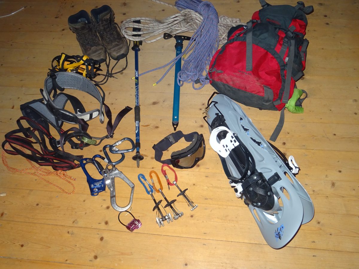
Another item I’ll carry is a walking rope as I’ve had some training in the use of this with regards to safe practices, knots, anchor points etc. But it’s just something that I hope I never have to use but one day I could glad I packed it. However this is really not a toy so I’d recommend if you’re planning on taking one along, make sure you’ve had proper training from a professional first.
It could be used for belaying or reassuring and giving confidence to someone who just suddenly decides they don’t like heights for some reason and are too scared stiff to move. Something around 8mm would be fine and Beal make a great one in 30m lengths.
If with a group over a number of days, you can share out the load and distribute the weight around or take turns carrying it. I’ll take this if on such a trip, or if just a day, I’ll carry my 15m length just in case, unless I know I’m going somewhere I expect to use a longer one. This 30m rope can also be tied into a stretcher for emergencies with the right know how.
Although they’re not really designed for climbing as they’re a bit thin and could easily fray on sharp rocks, it will hold about 160lbs of weight so theoretically could be used for a climb, but were this on my agenda I’d want a thicker and more comfortable rope. Also the 8mm one can be a bit sore as it’s so thin, so I’ve another pair of light but tough gloves just for handling the rope.
Rope is heavy, and wet rope is heavier, so again this is packed into a dry bag with the gloves for this purpose, as if caught in a prolonged downpour with your bag wetting out as the day gets on as you tire, not ideal.
Also in here there may be a sling (a loop of tape like material used in climbing) or two and these can be used in various ways and a karabiner attachment
- Cuppa Tea
And A Slice Of Cake
Lunch of course as you’ll need something to sustain your energy to haul all this stuff. I’ll not go into too much detail here. Could be for another post but I already covered this on another website, but I choose a lunch box to carry various things.
Also always bring a little more than you plan to eat, or have a stash of emergency food that lives in your bag fulltime, just rotating and replacing it now and then according to use by dates.
And 9 times out of 10, a flask with a hot drink, doesn’t have to be tea, can be soup, coffee, blackcurrant or whatever. This you’ll want when you stop for breaks but you may also want some water, possibly up to a litre or two to make sure you stay hydrated.
Water is possibly the heaviest thing you’ll carry in your bag most days but also possibly the most important. So in order to cut down on this weight I adopted a couple of strategies which have worked out for me so far.
- Always be well hydrated before setting off
- I may carry a small bottle with me at the start.
- By knowing my route by studying map of area,
I’ll know at what point in the day I’ll be near to streams or rivers and
therefore be able to quench my thirst here using a filter bottle.
This lowers the bag weight considerably meaning you save energy, so can carry less food as you need fewer calories to sustain the effort. It’s a sweet science when you think about it.
The Silva type four seems to be the industry standard in this part of the world at least, it’s been tried and tested by the thousand over the years and rarely if ever found to be lacking. Indeed there’s not really that much that can go wrong with them and they’re reliable generally as there’s no batteries going to die on you anytime soon.
That said however there are some exceptions to this rule and they can give misleading readings in certain circumstances. As you know the needle works magnetically, so if you’re standing too close to any steel structure, this is where you’re needle will be heading towards, even if that steel is on your south west.
Also in other locations there can be a heavy Iron or other metal content in the rock around you and again this’ll throw your needle some. If too close to electronics like smart phones or some GPS devices this also can reverse the polarity, and you’ll not know till you’ve possibly walked 180 degrees in the wrong direction for some time. So always try to keep your compass stored as far from your electronics as possible.
Another common problem is x ray machines at airports and travelling through these will damage a compass sometimes, again often reversing the polarity, so your north needle could be pointing south. But there’s a very simple fix for this. Use a magnet to reset it by holding it and running along the N end of the needle. A small fridge magnet would do, so sharp hikers carry one on them in their kit when travelling.
Other problems could be had if you lose or break it, say while out in stormy rugged terrain and maybe a high wind could take it or if you’re holding it but trip and end up landing on it. So it’s always good to carry at least two with you. I’ve a spare in my 1st aid kit, same type, Silva 4. But also most smart phones also have an app for this, as long as your battery holds.
A detailed map really is a powerful tool providing such a wealth of information about the locations you’ll find yourself in, if of course you know how to read it and are trained in the correct techniques of deciphering what it telling you and relating this to what you can, or sometimes can’t see around you.
It can be used for finding your exact location providing that you are holding it in the correct position, as dictated by a working compass and relating this to what you’re looking at both on the map, and on the ground around you.
It’ll tell you where to find water, possible shelter, possible help if needed and cliffs and dangers to avoid. They’re also invaluable for researching and route planning for your day before setting out. Couple this with a detailed and reliable weather forecast to make the most of it.
They come in different scales and levels of detail, so again I’ve always got mine in the bag and was glad of it on my last hike where the weather turned against us, so we got geographically misplaced for a few mins. We sorted it quick though. Again proper training and lots of practice required, but such a rewarding and enjoyable skill to have.
These again are great and versatile tools and for more than just walking, but this is their main function other than when being used for supporting your shelter while light weight back packing. Some folks use them all the time as a pair, others prefer using just the one.
As a pair and when used correctly they can take a lot off the pressure off your knees which tend to bother some hikers from the punishment they feel sometimes while hiking with a heavy back pack, especially going downhill. You’re knees do sometimes do take a bit of a battering.
But they’re also great for supporting yourself and aiding balance in tricky locations like rocky, broken terrain or crossing rivers. Use it to aid your buddy if they’ve none by reaching it across for them to grab once you’ve passed the danger maybe, or throw it to them if more sensible, depending on scenario.
So mines always in the bag when not in my hand. If you twist or sprain an ankle which is so easy to do you’ll be glad of it. If you’re with a big enough group, there’ll probably be a few pair between ye so if needed two pair can be used together with one of them cheap bivvy bags to fashion a stretcher.
Or should someone require a splint after breaking an arm or leg, and ye’ve nothing else, assuming you’ve got a trained 1st aider with you, a section of walking pole might be just what the doctor ordered, no pun intended.
There’s quite cheap but perfectly fine options, some coming in 2 or 3 part telescopic versions or if you want the lighter versions to save a little weight, you can expect to pay a higher price obviously. Weight loss comes with a price tag sometimes.
If you are off on a solo hike or if you somehow get separated from your group and perhaps fall or get stuck someplace, chances are you’ll need to call for help and shouting and screaming, might get you heard, but if not will get you tired fast, and a hoarse throat.
So bring a whistle attached to the shoulder strap for easy access in emergencies and it’s happened many times that a person has fallen into a hole or something and somehow broken or trapped both their arms. I do know a guy who did this, but he was fine, someone had thought him trick previously so he was able to get his pals to come back for him quickly enough.
If it in the right place, you can get your mouth to it without the use of your arms.
A set of 5 or 10 these on a cord next to the whistle are invaluable for measuring distance if navigating through the murk or at night time through featureless terrain.
You just can’t predict when you might get delayed out on a mountain top or in the wilderness someplace and end up losing daylight. This is one piece of kit you’ll be glad you brought in such an event. There’s hundreds of different types and models available in all different price ranges.
And it doesn’t have to be high end, however I would recommend not buying the cheapest you can lay your hands on. If you want quality and reassurance it’s worth paying a little more for one, this way you’ll surely get a guarantee with it, and at the end of the day, it could be getting you home in one piece some night and making sure you avoid nasty falls and trips, some potentially lethal.
So get a good light weight one, and a small one is fine, unless you’re planning on doing a lot of night navigation, which is always fun and one of my pet likes of things to do. And while stowed in your bag, always ensure to remove the batteries or turn one upside down so as it doesn’t get accidentally switched on in your bag so when you want it, batteries are dead.
Always worth bringing along a small one like a Leatherman or something similar. Even if you never use it, but guaranteed if you do get out hiking and exploring often, it will be used at some stage whether it be for fixing a hiking pole or cutting some rope, maybe you need a screw driver to repair some other piece of equipment.
Have used mine often and I’ll always carry a Swiss army knife too, and I think the thing that gets used most on this is the tweezers for thorns and stuff believe it or not. Cork screw’s come in useful also for the odd bottle of vino sitting at a campfire or in the tent for a celebration after a long day to mark an occasion.
- Nick Knack
Bag
Or bag of bits, or whatever you’d like to call it yourself. Every pro hiker or mountaineer will have something like this on their person and it’ll contain things like spare bootlaces, a snapped one can really slow a party down, raising the dangers of being caught out in bad weather or darkness.
Gore-Tex patches in case you get a hole or rip some of your rain gear. In cold climates, or even deserts where it’ll get cold at night, there’s hand warmers, these are widely available in any outdoor retailer as a gel pack thing you just snap, it’ll heat up and stay hot for 4/5 hours. You can put them inside your gloves, or under the arm pits of someone suffering from hypothermia to help warm them.
I’ve actually got a nice stainless steel version which works like a Zippo lighter, made by a company called Peacock, you just fill with lighter fluid obviously either on site or before leaving home and store away from your food. This I’ll carry in winter along with a couple of the gel snap packs if I’m with a group.
Vaseline is a handy thing to have for any number of reasons, and I’ve seen lots of my friends carry for the likes of chapped lips caused by dry air and cold climates. There’s the stick version, but I prefer the small tin version, as just on the off chance you do need to signal to someone for assistance over long distances, on a sunny day we’ll say, the inside of the tin makes for an ideal mirror.
But it’s also very good for waterproofing certain bits of gear, possibly a tent or jacket which has become a little worn here and there, and because Vaseline is petroleum based, it’s also very combustible so if you need a fire lit quick but everything around you is wet, a little cotton wool or similar, coated in this will have your fire lighting in no time.
Which brings me to lighters, a good thing to carry. Even if it’s just in case your pal who refuses to quit smoking, but he/she needs a light now or they’re gonna snap, you can help them out. Duct tape/Gorilla tape because you just never know. Just a small amount wrapped around the lighter or possibly a walking pole or something.
Sole fell off my boot one time and my buddy had some this day, we taped the boot together and kept going.
Ear plugs, and this is a pro tip I got from a well-trained Paramedic in the mountain rescue team. I mean they weigh nothing, but if you ever are in the vicinity of a helicopter rescue someday, and if you know what to do or are asked to assist, these are extremely noisy things and at the risk of burst or damaged ear drums, so I’ll have a couple of these in there also, one for me and a pal just in case. They’ll cost like 50c in your nearest chemist/drug store.
I still do carry just in case asked for it or I gotta go, some toilet paper, for sometimes nature does call and when ya gotta go ya gotta go, however to keep in line with leave no trace this should be biodegradable so it’ll not last too long or be found at the wrong time and place by some other unfortunate because it’s been dug up by an animal or something, but that’s all for another discussion.
Dextrose, don’t leave home without them, another pro tip from the paramedics. Little sweets you’ll get in any good chemist, but they’re like rocket fuel. There almost 100% glucose, so for when you’re wrecked tired or a friend of yours may be, so need a little extra push up the final climb of the day perhaps. Just drop one of these and you’ll be dancing again.
Not sure if I’d recommend the dextrose for diabetics however, but if in any doubt, have a word with your GP for recommendations here.
So That’s What’s In The Bag
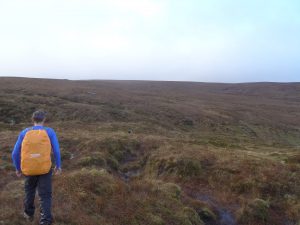
So these are the things I’d be carrying for a days’ hiking in summertime around these parts, Ireland or UK, Scotland etc. During the winter there’d also be things like snowshoes, crampons ice axes and other devices but I may do another post on this gear in the near future.
We’d use a slightly larger rucksack and definitely will depending on our chosen adventure at the time.
- Optional
Extras
Other things I’d be inclined to carry are going to be things like a camera for recording your trip and a monocular, for seeing things far off quickly/ route finding. Same as binoculars but at half the weight. If on a long day or multi day event, a power bank will be invaluable for re-charging a smart phone, for some folks who use theirs a lot for route finding which will drain your phone really quickly.
There’s many different types available and these have differing sizes and capabilities according to what you intend to pay for one.
Also if I’ve a team in place in order to look after a group of people in wild terrain where often there may be no phone coverage, or if having more than one team in place, walkie talkies will be in the kit also.
Getting accurate weather forecasts are very important also or being able to read the conditions around you some folks will carry a barometer for this, a wind watch, or both.
Personal Locators beacons are also a very handy thing to have if heading someplace remote with a group you’re responsible for maybe.
So that about covers it for now and I hope some of you may have picked up on a tip or two, so please feel free to get in touch with any questions or suggestions you may have or if you believe I’ve left anything out, please get in touch and let me know what you think.
All the best, N.

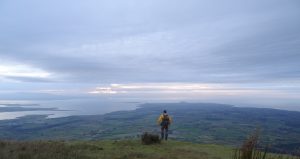
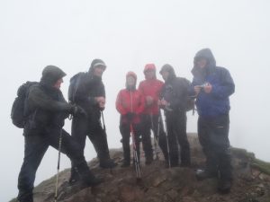 Donegal, magical, mystical, spectacular and voted by National Geographic no less, as the number one destination on the planet for adventure holidays recently. This is the home of the mighty Glover Challenge, a very popular route on the Irish challenge walks calendar, with which I had unfinished business. After attempting this route two years ago in horrendous weather conditions and opting to pull out due to concern for myself and those around me who might choose to follow had we continued.
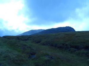 probably, meeting the team at 6:15 am to head on our adventure? This didn’t seem to make a lot of sense to me so plan b came into effect. It’s just a 2hr30min drive from my house to meeting point, hostel, so leaving at 3:30 should give me lots of time and traffic would be light.
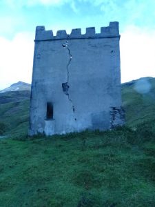
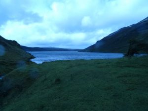
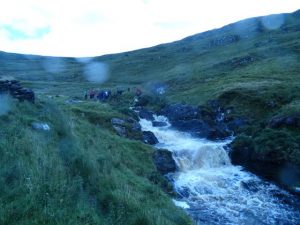

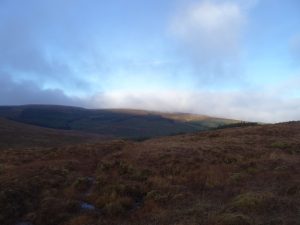
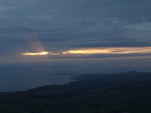
 ground would be swamped. After crossing the river fairly high up on some convenient stepping stones, we decided on a break to lighten our bags of some of the food and drink we brought. This for some can be the best part of the day, depending on what you’ve packed. So Knockalongy was to be our next checkpoint and we’d to head N/NE, hand-railing the forestry boundary before a nice gradual incline and the going was good. Dusk was just upon us and the lighting and the colors could just leave you stuck for words, with the greens and browns from the otherworldly peat hags,
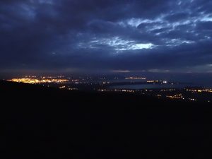
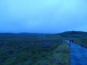
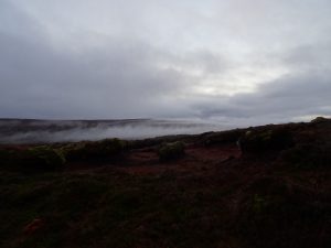 to the fiery reds and oranges struggling to make themselves known through the mist, just hugging the ground here and there. Finally our objective is in sight, the trig point which marks Knockalongy, the highest point in the ox mountain range and then were there. Just in time to grab a few snaps before full dark and the fun really begins. We take time to sign the geo cache book and surprise surprise, ours are the 1st names to go in it this year, a little time to take in where we are before the game of find the cars as Barry likes to call it begins. Get out our head torches and flip the battery around so we’ve power, time to go. It’s all downhill from here and the best thing I find to do is follow land marks and features.
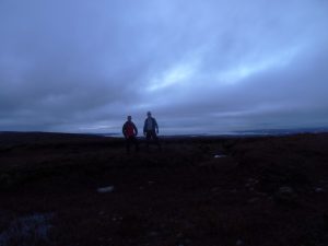
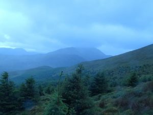
 We’ve a well chosen group of walks and hikes to suit all age and fitness levels, lot’s of them just happen to be based around the West/North West, as this is my back yard at the moment. You’ll find stunning scenery and well known landmarks, alongside some hidden gems we like to keep to ourselves hah, lest they become too overcrowded. From high mountains to valleys low, you’ll never know unless ya go.